A rebalanced network
We've developed a Street User Matrix to guide how each road should function—whether it's a place to linger, a route for buses, or a corridor for freight. This helps us prioritise the right modes in the right places.
“Some routes will have multiple functions, and trade-offs will be needed in how we manage street space.”
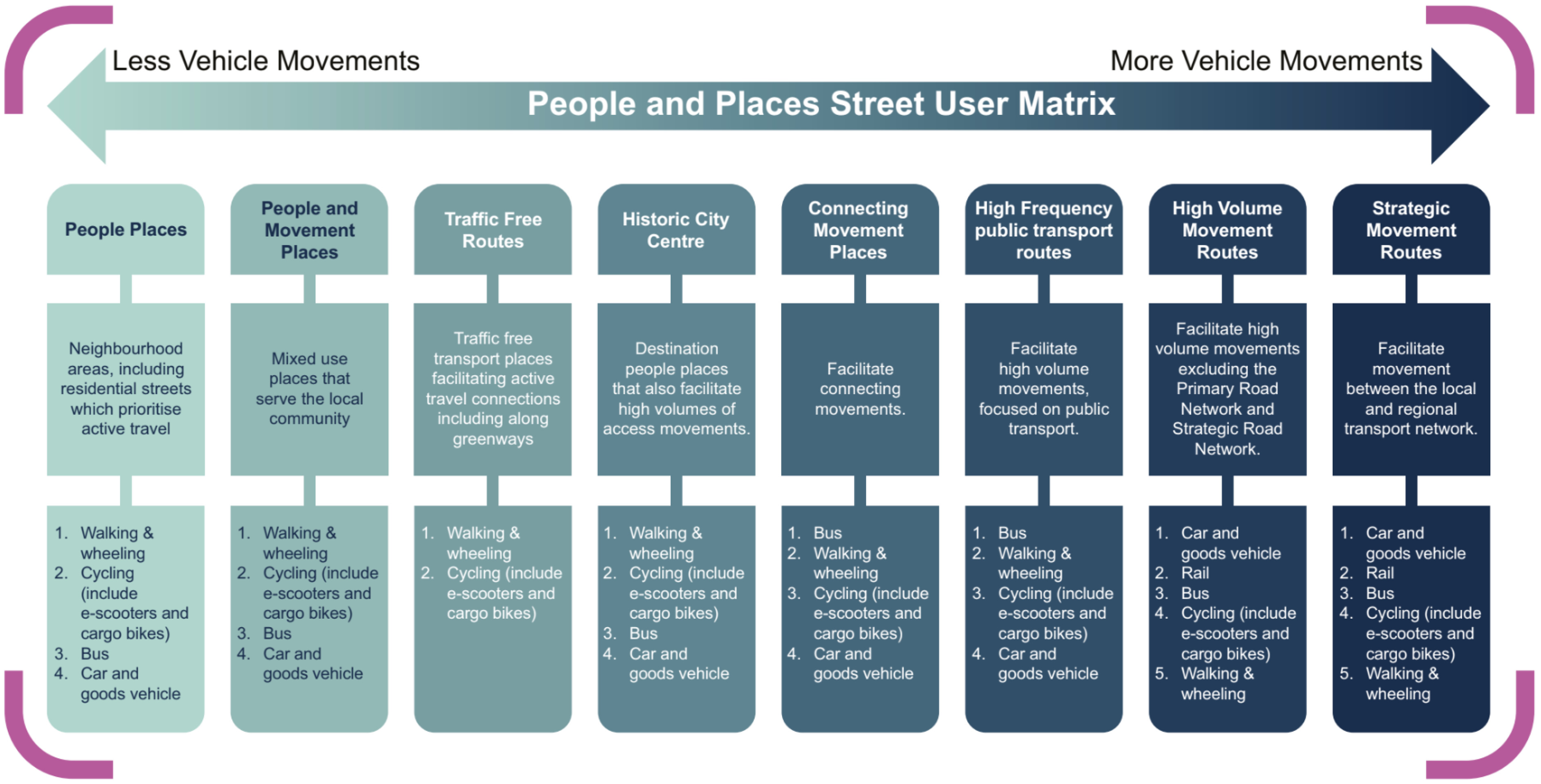
Street user matrix - click to enlarge
Walking, wheeling and cycling
- 36% of daily trips are within Bath—many could be made by active travel.
- We'll deliver safer speed limits, wider pavements, better crossings, and protected cycle lanes.
- Greener routes with planting and street trees will improve wellbeing and climate resilience.
“We have an ambition for Bath to be a walkable and wheelable city.”
Buses
- Bus priority corridors will reduce delays and improve reliability.
- Interchange hubs will be upgraded to support Park & Ride, tourism, and evening travel.
- Mobility hubs will offer first/last mile options like bike and scooter parking.
“Faster and more frequent bus services will be critical for many journeys within and into the city.”
General traffic and freight
- Strategic A-roads will carry through-traffic and freight, reducing pressure on central streets.
- Freight consolidation centres will reduce HGV traffic in sensitive areas.
- Parking and signage strategies will guide drivers to appropriate routes and facilities.
“We are seeking to reduce general traffic through various levers… freeing space on streets that are not appropriate for large volumes of traffic.”
Public realm enhancements
- Queen Square, Milsom Quarter, Parade Gardens, and the Bath Riverline will be revitalised.
- These spaces will become greener, safer, and more welcoming for residents and visitors.
- Improvements will support Bath's status as a World Heritage Site and boost the local economy.
To read more about what the strategy would look like, check out our full Movement Strategy here